|
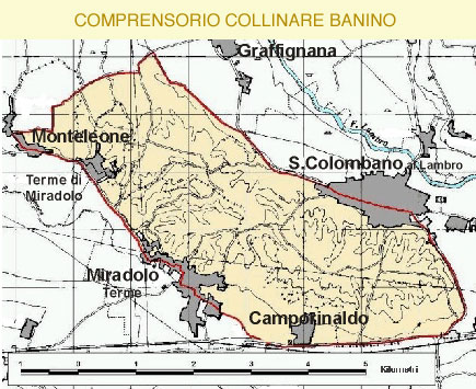
The San Colombano Hill extends from East to West for about eight kilometers and from North to South by a couple, and is less than fifteen kilometers from the foothills of the Apennines. The structure of the soil is predominantly based on silt, although there are plenty of areas with a prevalence of sand and the presence of limestone, while the subsoil is very rich in minerals. According to a recent territorial study carried out by ERSAL (regional body for the agricultural development in Lombardy) the territory of the Banini Hills district can be referred to as a system of soil landscapes, that is, of level terraces raised above the plain, constituting ancient areas saved from erosion. In turn, this system is composed of subsystems of landscapes largely linked to:
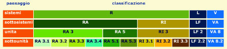
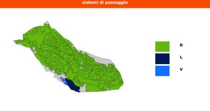
- RA type (ancient terraces raised from the plain made up of coarse materials)
- RI (intermediate terraces, lower than RA)
- LF (southern portions of the plain made up of fine river sediments)
- VA (flood plain, made up of recent sediments, in the Miradolo spa area).
The principal element of the soil landscape is the “landscape unit” understood as areas of ground which have had the same formation and present the same morphological characteristics.
The soil landscape units can be linked together to form larger landscape groups.
In Lombardy, the categories of soil landscapes have been defined and classified according to the following hierarchy.
 |
|
 |
|
|
|